All Resources
Near Infrared Mapping Spectrometer Observation of Europa
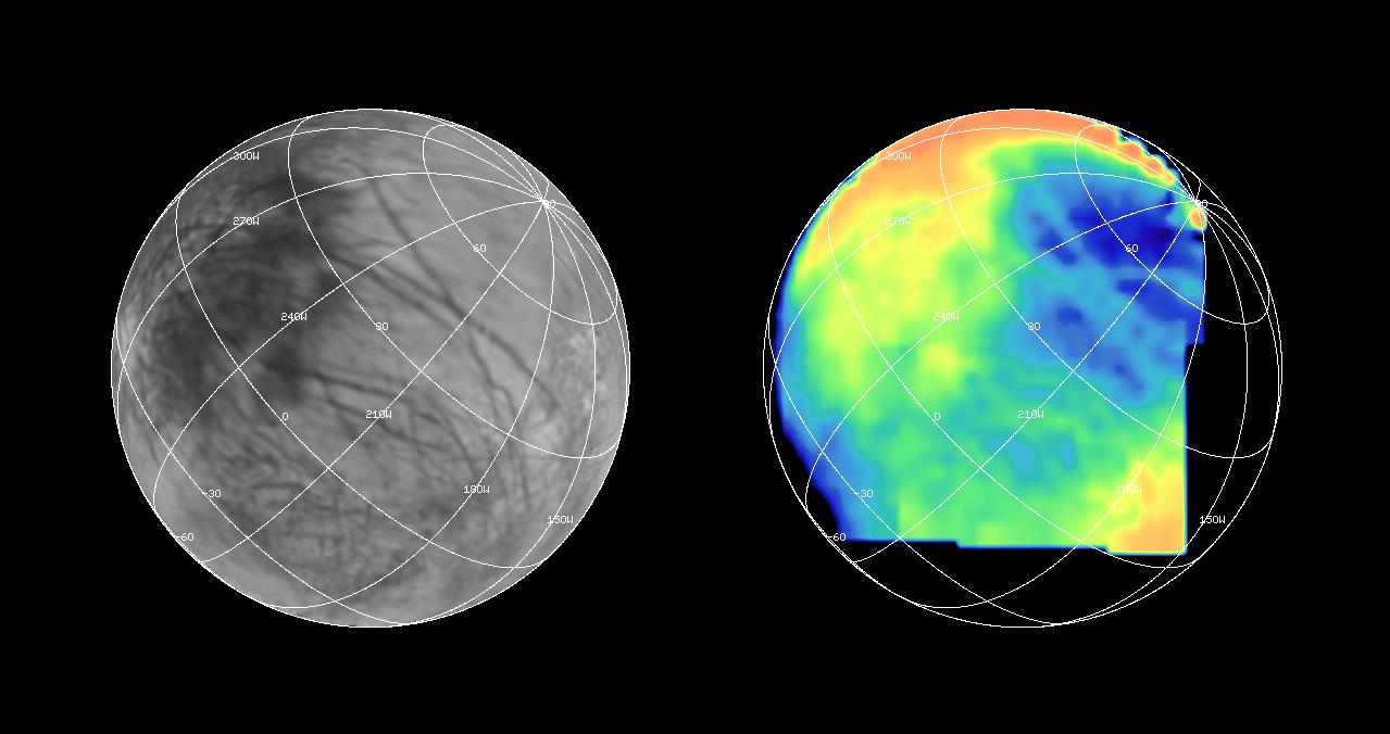
The Near Infrared Mapping Spectrometer (NIMS) on the Galileo spacecraft imaged most of Europa, including the north polar regions, at high spectral resolution at a range of 97,500 miles (156,000 kilometers) during the G1 encounter on June 28 1996.
The image on the right shows Europa as seen by NIMS, centered on 25 degrees N latitude, 220 W longitude. This is the hemisphere that always faces away from Jupiter. The image on the left shows the same view point from the Voyager data (from the encounters in 1979 and 1980).
The NIMS image is in the 1.5 micron water band, in the infrared part of the spectrum. Comparison of the two images, infrared to visible, shows a marked brightness contrast in the NIMS 1.5 micron water band from area to area on the surface of Europa, demonstrating the sensitivity of NIMS to compositional changes. NIMS spectra show surface compositions ranging from pure water ice to mixtures of water and other minerals which appear bright in the infrared.