All Resources
Europa Ridges, Plains and Mountains
Original Release Date: Dec. 16, 1997
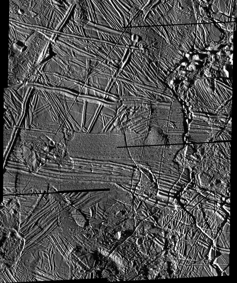
This mosaic of images from NASA's Galileo spacecraft camera shows some of the highest resolution images of Jupiter's moon Europa ever acquired. The hundreds of ridges that cut across each other indicate multiple episodes of ridge formation either by volcanic or tectonic activity within the ice.
The images were taken on Nov. 6, 1997 from a range of about 1,990 miles (3,250 kilometers). North is to the top of the image and the Sun illuminates the scene from the left.
Also visible in the image are numerous isolated mountains or "massifs". The highest of these, located in the upper right corner and lower center of the mosaic, are approximately 1,640 feet (500 meters) high.
Irregularly shaped areas where the ice surface appears to be lower than the surrounding plains (in the left-center and lower left corner of the mosaic) may be related to the chaotic areas of iceberg-like features seen in earlier Galileo images of Europa. The mosaic, centered at 35.4 degrees north latitude and 86.8 degrees west longitude, covers an area of 108 by 90 miles (66 by 55 kilometers). The smallest distinguishable features in the image are about 223 feet (68 meters) across.