All Resources
Europa Ice Rafts
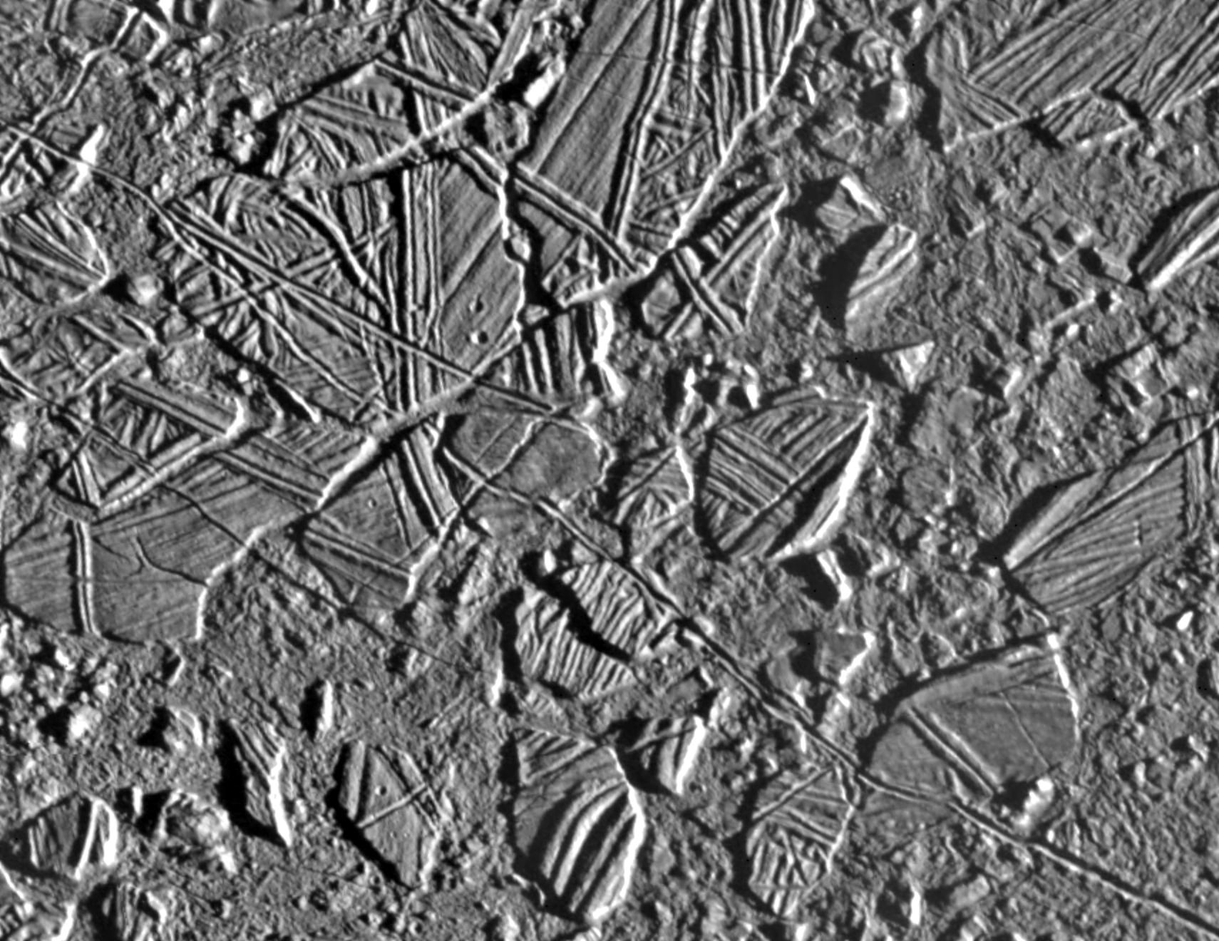
This high resolution image shows the ice-rich crust of Europa, one of the moons of Jupiter. Seen here are crustal plates ranging up to 8 miles (13 kilometers) across, which have been broken apart and "rafted" into new positions, superficially resembling the disruption of pack-ice on polar seas during spring thaws on Earth. The size and geometry of these features suggest that motion was enabled by ice-crusted water or soft ice close to the surface at the time of disruption.
The area shown is about 21 miles by 26 miles (34 kilometers by 42 kilometers), centered at 9.4 degrees north latitude, 274 degrees west longitude, and the resolution is 59 yards (54 meters). This picture was taken by the Solid State Imaging system on board the Galileo spacecraft on Feb. 20, 1997, from a distance of 3,320 miles (5,340 kilometers) during the spacecraft's close flyby of Europa.