All Resources
Near-Infrared Mapping Coverage of Europa
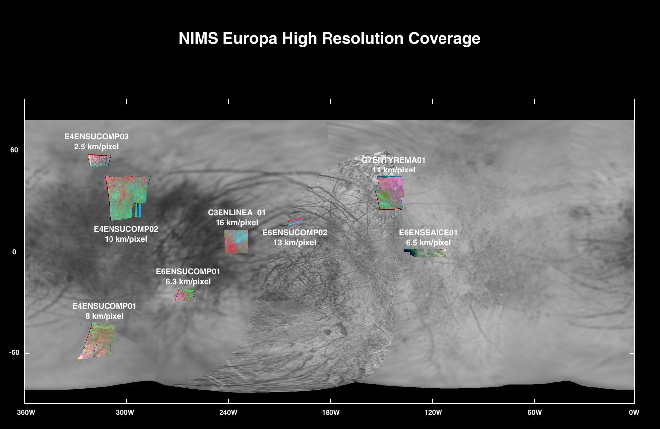
Galileo orbiter near-infrared observations of Europa overlayed on a Voyager map.
Original Caption-March 26, 1998
The NIMS instrument on the Galileo spacecraft, which is being used to map the mineral and ice properties over the surfaces of the Jovian moons, produces global spectral images at modest spatial resolution and high resolution spectral images for small selected regions on the satellites. This map illustrates the high resolution coverage of Europa obtained by NIMS through the April 1997 G7 orbit.
The areas covered are displayed on a Voyager-derived map. A good sampling of the dark trailing-side material (180 to 360 degrees) has been obtained, with less coverage of Europa's leading side.
The false-color composites use red, green and blue to represent the infrared brightnesses at 0.7, 1.51 and 1.82 microns respectively. Considerable variations are evident and are related to the composition and sizes of the surface grains.