All Resources
Icy Cliffs at High Resolution
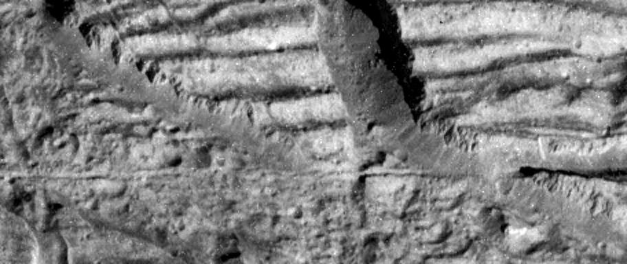
This image, taken by the camera onboard NASA's Galileo spacecraft, is a very high resolution view of the Conamara Chaos region on Europa. It shows an area where icy plates have been broken apart and moved around.
The top of this image is dominated by corrugated plateaus ending in icy cliffs a few hundred feet (over a hundred meters) high. Debris piled at the base of the cliffs can be resolved down to blocks the size of a house. The narrow fracture that runs horizontally across and just below the center of the image is about the width of a freeway.
North is to the top right of the image, and the sun illuminates the surface from the east. The image is centered at approximately 9 degrees north latitude and 274 degrees west longitude. The image covers an area approximately 1 mile by 2.5 miles (1.7 kilometers by 4 kilometers). The resolution is 30 feet (9 meters) per picture element. This image was taken on December 16, 1997 at a range of 540 miles (900 kilometers) by Galileo's solid state imaging system.