All Resources
Scrambled Ice
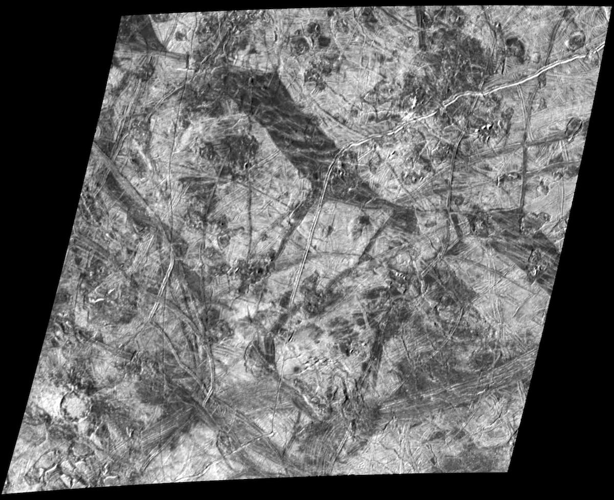
This complex area on the side of Europa which faces away from Jupiter shows several types of features which are formed by disruptions of Europa's icy crust. North is to the top of the image, taken by NASA's Galileo spacecraft, and the Sun illuminates the surface from the left. The prominent wide, dark bands are up to 12 miles (20 kilometers) wide and over 30 miles (50 kilometers) long. They are believed to have formed when Europa's icy crust fractured, separated and filled in with darker, "dirtier" ice or slush from below. A relatively rare type of feature on Europa is the 9.3-mile-diameter (15-kilometer) impact crater in the lower left corner. The small number of impact craters on Europa's surface is an indication of its relatively young age. A region of chaotic terrain south of this impact crater contains crustal plates which have broken apart and rafted into new positions. Some of these "ice rafts" are nearly half a mile (about 1 kilometer) across. Other regions of chaotic terrain are visible and indicate heating and disruption of Europa's icy crust from below. The youngest features in this scene are the long, narrow cracks in the ice which cut across all other features. One of these cracks is about 18 miles (30 kilometers) to the right of the impact crater and extends for hundreds of miles from the top to the bottom of the image.
The image, centered near 23 degrees south latitude and 179 degrees longitude, covers an area about 150 by 130 miles (240 by 215 kilometers) across. The finest details that can be discerned in this picture are about 500 yards (460 meters) across. The image was taken as Galileo flew by Europa on March 29, 1998. The image was taken by the onboard solid state imaging system camera from an altitude of 14,000 miles (23,000 kilometers).