All Resources
Very High Resolution Image of Icy Cliffs on Europa and Similar Scales on Earth (Providence, RI)
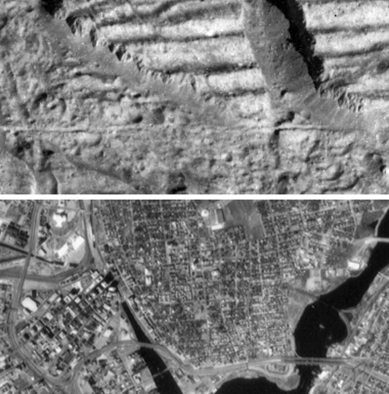
The top image is a very high resolution view of the Conamara Chaos region on Jupiter's moon Europa, showing an area where icy plates have been broken apart and moved around laterally. The top of this image is dominated by corrugated plateaus ending in icy cliffs a few hundred feet (over a hundred meters) high. Debris piled at the base of the cliffs. The bottom image is an aerial photograph of downtown Providence, Rhode Island at the same scale. The bright white circular feature in the top center of the Providence image is an indoor hockey rink, and one can find many craters in the Europa image about the same size. Blocks of debris which have fallen from the cliffs on the Europa image are about the same size as houses seen in the Providence image, and the largest blocks are almost as large as the Rhode Island state capitol building (large white building in upper left of Providence image). A fracture that runs horizontally across the center of the Europa image is about the same width as the freeway which runs along the bottom of the Providence image.
North is to the top right of the Europa image, and the sun illuminates the surface from the east. The Europa image is centered at approximately 9 degrees north latitude and 274 degrees west longitude. The images each cover an area approximately 1 mile by 2.5 miles (1.7 kilometers by 4 kilometers). The resolution is 30 feet (9 meters) per picture element. The Europa image was taken on Dec. 16, 1997 at a range of 540 miles (900 kilometers) by the solid state imaging system on NASA's Galileo spacecraft.