All Resources
Dome-Shaped Features on Europa
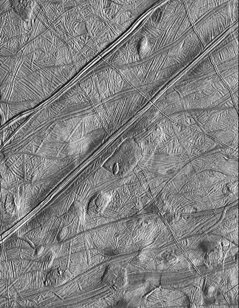
Ridges disrupted by the localized formation of domes may be indicative of thermal upwelling of water from beneath Europa's crust.
Original Caption
The Solid State Imaging system aboard the spacecraft Galileo took this image of the surface of Europa on February 20, 1997 during its sixth orbit around Jupiter.
The image is located near 16 North, 268 West; illumination is from the lower-right. The area covered is approximately 48 miles (80 kilometers) by 56 miles (95 kilometers) across. North is toward the top of the image.
This image reveals that the icy surface of Europa has been disrupted by ridges and faults numerous times during its past. These ridges have themselves been disrupted by the localized formation of domes and other features that may be indicative of thermal upwelling of water from beneath the crust. These features provide strong evidence for the presence of subsurface liquid during Europa's recent past.