All Resources
Pwyll Impact Crater: Perspective View of Topographic Model
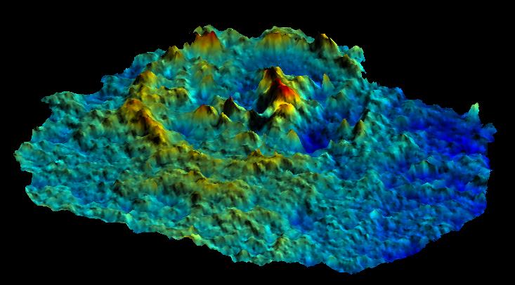
This computer-generated perspective view of the Pwyll impact crater on Jupiter's moon Europa was created using images taken by NASA's Galileo spacecraft camera when the spacecraft flew past that moon on Feb. 20 and Dec. 16, 1997 during its 6th and 12th orbits of Jupiter. Images of the crater taken from different angles on the different orbits have been combined to generate a model of the topography of Pwyll and its surroundings. This simulated view is from the southwest at a 45 degree angle, with the vertical exaggerated four times the natural size. The colors represent different elevation levels with blue being the lowest and red the highest. Pwyll, about 16 miles (26 kilometers) across, is unusual among craters in the solar system, because its floor is at about the same elevation as the surrounding terrain. Moreover, its central peak, standing almost 2,000 feet (approximately 600 meters) above the floor, is much higher than its rim. This may indicate that the crater was modified shortly after its formation by the flow of underlying warm ice.