All Resources
Close-up of Europa's Surface
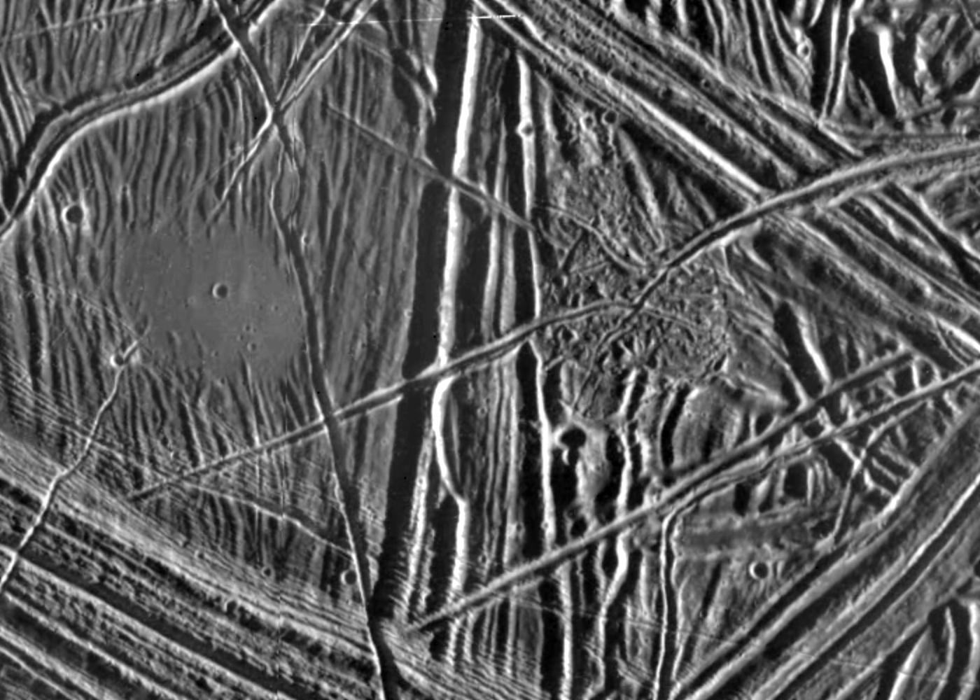
This close-up view of the icy surface of Europa, a moon of Jupiter, was obtained on Dec. 20, 1996, by the Solid State Imaging system on board the Galileo spacecraft during its fourth orbit around Jupiter. The view is about 7 miles by 10 miles (11 kilometers by 16 kilometers) and has a resolution of 28 yards (26 meters). The Sun illuminates the scene from the east (right).
A flat smooth area about 2 miles (3.2 kilometers) across is seen in the left part of the picture. This area resulted from flooding by a fluid which erupted onto the surface and buried sets of ridges and grooves. The smooth area contrasts with a distinctly rugged patch of terrain farther east, to the right of the prominent ridge system running down the middle of the picture. The rugged patch of terrain is 2.5 miles (4 kilometers) across and represents localized disruption of the complex network of ridges in the area. Eruptions of material onto the surface, crustal disruption, and the formation of complex networks of folded and faulted ridges show that significant energy was available in the interior of Europa. Although small impact craters are most easily seen in the smooth area, they occur throughout the ridged terrain seen in this view.